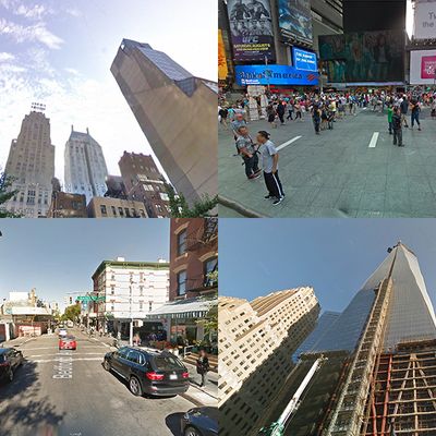
Last week, Google unveiled a new feature in maps called Time Machine, allowing users to browse old location photos in Street View. The company’s camera-outfitted cars began crisscrossing the city (and the country) in 2007, capturing images of pretty much everything. As the process was repeated over the past six years, Google has accumulated an archive — unavailable to the public until now — of snapshots showing how any given place has evolved.
Some of the more notable changes in New York’s cityscape are the result of major projects backed by former Mayor Bloomberg. To name a few: the reconfiguration of Times Square, the construction of the country’s tallest building, and the growth of Williamsburg from a sleepy little North Brooklyn neighborhood to an overbuilt place everyone around the world can hate. Taking a ride in Google’s new Time Machine, we decided to explore some notable spots around New York City and document the changes in GIF form.
Times Square: One of the defining policies of the Bloomberg era was the effective banishing of cars from Times Square, solidifying the decades-long evolution of the area from seedy backwater to family friendly tourist Mecca. Here, the transformation of Times Square is shown from 2007 to 2012.
One World Trade Center: The construction of One World Trade Center took years to get under way — preliminary work on the building didn’t begin until 2006, and several more years passed before the structure began to take shape. The first frame shown here is from September 2007, with the tower becoming visible by June 2011. One World Trade topped out at 1,776 feet in November 2013.
Lower Manhattan: One World Trade Center emerges into the Manhattan skyline by June 2012 in this view of the city from the Brooklyn-Queens Expressway, which begins in August 2007 and ends in October of last year. Construction of Brooklyn Bridge Park began in 2008 and is visible in the foreground.
One57: The first of 57th Street’s 1,000-foot towers, the still-in-progress luxury skyscraper One57 began construction in 2010 and was soon casting shadows over annoyed parkgoers a few blocks north. Google captured its progress from 2008 to 2013.
Cooper Union: The Cooper Union building opened in Cooper Square in 2009, welcomed as “an East Village homage to the Left Bank” by New York critic Justin Davidson. Google’s cameras captured the pre-construction site in September 2007.
Williamsburg: Williamsburg is the neighborhood everyone loves to hate, and the Brooklyn enclave has become emblematic of the gentrification during the Bloomberg years. Here, Google cars traversing the Williamsburg Bridge captured the changing waterfront beginning in 2007. And it will soon look much different — the site of the Domino Sugar refinery will be replaced with looming 55-story towers, following a deal between the de Blasio administration and developers.
Bedford Avenue: The Bedford Avenue L stop is the epicenter of Brooklyn hipsterism. The intersection of Bedford and North 7th Street is shown here from August 2007 to January 2013.
Barclays Center: The construction of Brooklyn’s Barclays Center was very nearly derailed by the recession, and legal disputes kept the plan in limbo for years before developers broke ground in 2010. The early skeleton of the structure shown below was photographed by Google in June 2011. Today, Barclays rivals Madison Square Garden as the city’s preeminent concert and sports venue.


