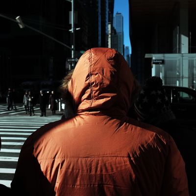
An Arctic air mass is about to send temperatures plummeting across the northern United States. The blast of freezing-cold air will be quick, but painful: Highs won’t make it out of the single digits in places like Chicago and Detroit starting Thursday. New York will get the worst of it overnight, from Thursday into Friday, says New York Metro Weather’s John Homenuk, with temperatures spiraling into the teens. Which is poor consolation when the wind chill will make it feel about zero degrees — or below.
Homenuk says New York City probably won’t break any temperature records, but this brutal cold is “definitely not normal this time of year.” And it’s made more horrible because New Yorkers, after last year, may have forgotten what real December feels like. So to help everyone cope, Homenuk walked Daily Intelligencer through this latest “polar vortex” phenomenon, and what to maybe expect, weatherwise, come holiday (vacation) time.
It seems as if the entire northern United States is going to be in a deep freeze. What’s going on?
This big ridge of high pressure built from Alaska to almost the North Pole. Basically, what the ridge does is take the air mass that is typically bottled up near the Arctic region and it disrupts that air. This ridge is very strong, and it built itself up there for several days, so this big area of Arctic air was completely dislodged, and it’s coming down south.
So is this technically a “polar vortex”?
By definition, the polar vortex exists all year, and on multiple levels of the atmosphere. So imagine as if it’s a circle that’s constantly spinning. The natural tendency of the cold air is to stay in the Arctic. But when a ridge of high pressure builds and pushes up [into the polar vortex], a piece of that has nowhere to go, and it dislodges. A piece of the cold will drop southward and into Canada and New England Thursday and Friday — very quickly.
So what can we expect in the New York region?
Thursday night into Friday morning will be the coldest. Temperatures will get down into the teens. Historically speaking, it isn’t that dramatically cold, but with the wind chill, it will be near or slightly below zero. It’s going to feel zero.
What about snow?
It is pretty likely that it’s going to snow a bit on Saturday, but it will change over to rain as the very cold air mass is going to be departing and rather quickly replaced by warm air that is surging our way from the South.
What’s the longer-term forecast for the rest of December — and this winter?
Our winter forecast did call for a colder December — so everything is on track, near average or slightly below average. Barring this pattern, it will warm up a bit as we go toward the holidays. If anything, it looked to us that February would be a month that’s warmer than normal, and December looked to be colder than normal. Beyond that, the certainty is really, really low.
This interview has been edited and condensed for clarity.


